Round Trip Distance: 1.2 Miles
Trail Rating: Moderate difficulty , well maintained trail. Moderate elevation change
(steep for short distance).
Reference: PATC Map 11 (available at entrance stations)
Reference: Heatwole's Guide
Between milepost 100 and 99 you will find Beagle Gap. The famous Appalacian Trail crosses Skyline Drive here. It is marked by white paint blazes and either direction will provide an interesting walk.
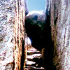
1. Little Calf Mountain (AT North) length .6 mi. Go through the fence behind the parking area and walk uphill through the old apple orchard. You will enter a thick pine forest and climb steeply for a short distance. Take the unmarked trail to your left when you emerge from the pines and you will have a very short walk to the summit of Little Calf Mountain. The view is truely panoramic.
2. Bear Den Mountain (AT south) length .5 miles. Cross the road from the Beagle Gap parking area and walk up the mountain with all the antennas on it. The sweeping vista you will enjoy is worth the walk.