1. Jones Run Falls
Round Trip Distance: 3.6mi. to falls.
Trail Rating: Moderate difficulty. 915' elevation change, uphill return.
Reference: PATC Map11 (available at entrance stations).
Reference: Heatwole's Guide
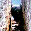
From Jones Run parking area at milepost 84.1 on Skyline Drive, follow the Jones Run Trail (blue blazed) as it crosses the Appalacian Trail (white Blazed) and down into the hollow. Cedar Mountain rises just to the right of the hollow in the distance. In 1.7 miles you will be at the top of the waterfall. Continue on down to the base to view this unique cascade that descends the cliff at an angle. The mossy rocks and ferns will refresh your spirit on a hot day.
2. Doyle's River Falls
Round Trip Distance: 3.3mi. to lower falls.
Trail Rating: Moderate difficulty. Uphill return.
Reference: PATC Map11 (available at entrance stations).
This wonderfully verdant hollow features two nice waterfalls, and since it's only .3mi. from the upper falls to the lower, leave time to explore both. At milepost 81.1 of Skyline Drive begin at the Doyle's River parking area and follow the blue blazed trail. You will cross the Appalacian Trail and pass Doyle's River Cabin. Cross the Brown's Gap Road (yellow Blazed) and continue on the blue blazed trail until you reach the top of the upper falls. From here on down you can enjoy a small rock-walled canyon wonderland as you walk to the lower falls. After you see the lower falls, return the same way you came.
3. Jones Run and Doyle's River as a loop
Loop Distance: 6.6mi.
Trail Rating: Moderate difficulty.
Reference: PATC Map11 (available at entrance stations).
Reference: PATC Guide: "Circuit Hikes in Shenandoah National Park", page 83
Looking for a good long walk on a warm summer day? Here's a wonderful trek through cool verdant hollows with mossy rocks, cascading streams and a series of delightful waterfalls. Begin at Jones Run trailhead (milepost 84.1) and follow the blue blazed trail to Jones Run Falls as described above. Continue on the blue blazed trail which eventually reaches the confluence of Jones Run and Doyle's. There is a marker here but you continue on the blue blazed (and only) trail. You cross a small footbridge after passing through an area rich in wildflowers and you will be heading upstream on Doyle's River. After visiting the lower and upper falls you will come to the Brown's Gap Road (yellow blazed). Turn left here and cross the bridge. Continue on Brown's Gap Road, which was used by General Thomas Jackson's troops during the famous valley campaign. You will pass by the grave of William H. Howard, a soldier of the 44th Virginia Infantry, CSA, "F" Company. It is off the road to the right on a spur trail. You will arrive shortly at Brown's Gap on Skyline Drive. Follow the drive to the left until you pick up the Appalacian Trail (white blazed) and take it to the left (South). You will walk over a small hill and past the Dundo Campground to the junction with the Jones Run Trail. Turn right here and return to the parking area.